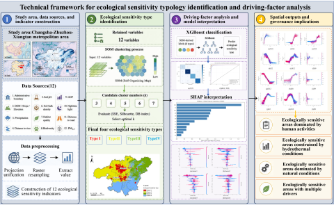
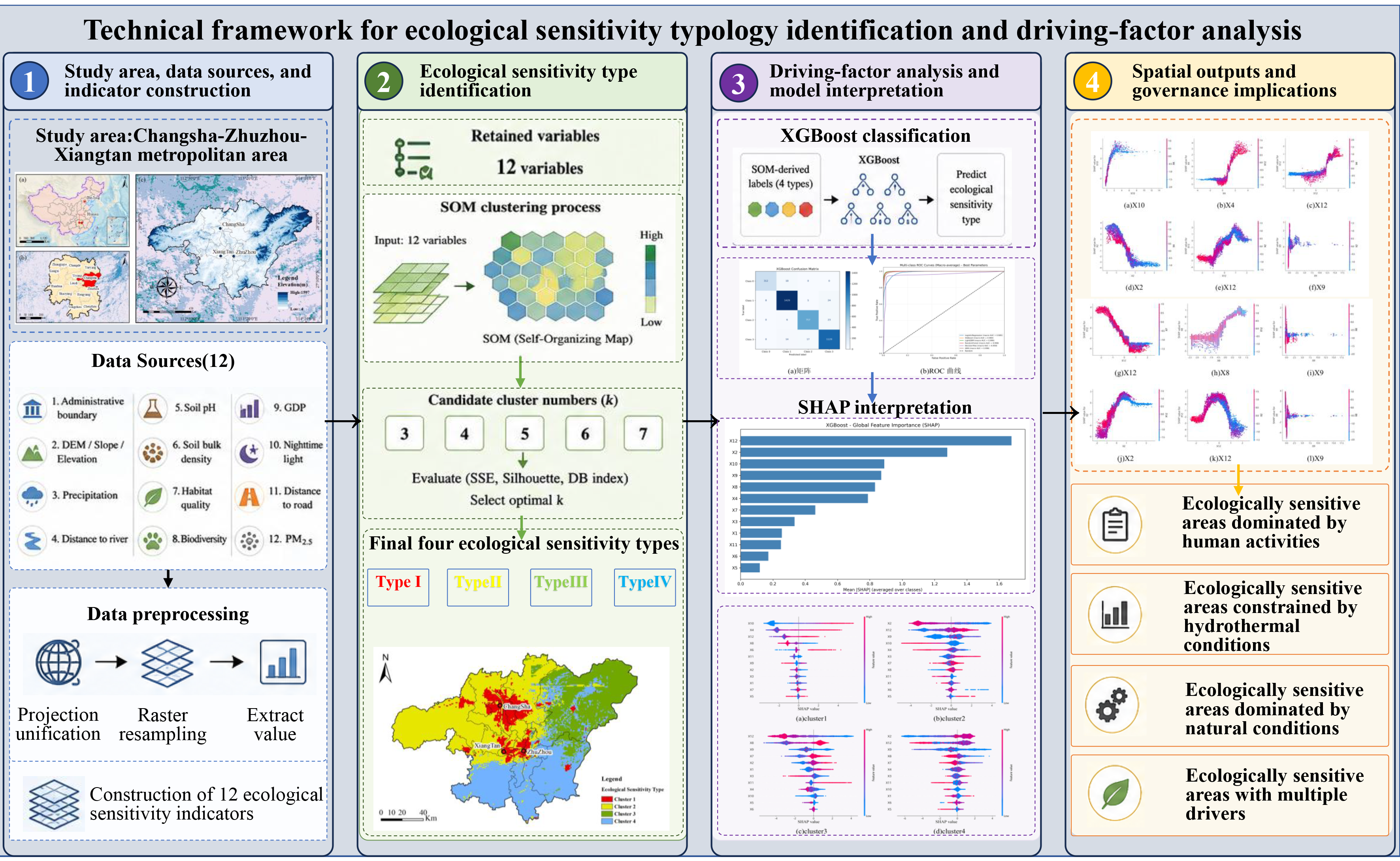
Rapid urbanization has intensified ecological pressure and increased the complexity of ecological responses in metropolitan areas. This study identified ecological sensitivity types and their associated environmental patterns in the Changsha–Zhuzhou–Xiangtan metropolitan area. Twelve indicators representing natural geography, soil environment, ecological background, and anthropogenic disturbance were analysed using self-organizing maps, XGBoost, and SHAP. Four types were identified: anthropogenic activity-associated, hydrothermal constraint-associated, ecological background-associated, and natural–anthropogenic composite-associated areas, accounting for 8.78%, 38.85%, 21.16%, and 31.21% of the study area, respectively. PM₂.₅ had the highest mean absolute SHAP value, followed by annual precipitation, nighttime light, GDP, animal diversity, and land-surface temperature. These variables should be interpreted as factors associated with model classification rather than as evidence of causal ecological drivers. The four types exhibited distinct association patterns, supporting differentiated ecological governance and spatial planning in rapidly urbanizing metropolitan areas.